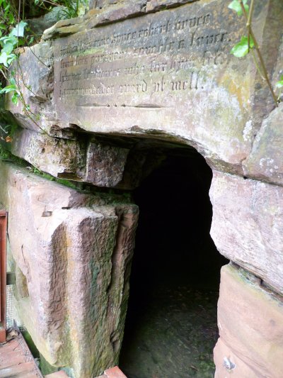
Scotland: August 2011

The costly ferry charges and the dismal £/euro exchange rate made a trip across the Channel much less attractive this year.
Inspiration! - "Let's introduce Rosemarie to those Scottish hills where Alec climbed in his youth".
So with only a couple of days planning we headed north instead.

Bruce's cave

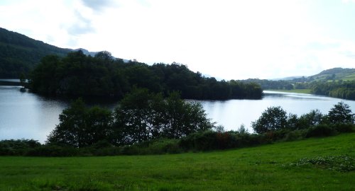
The 350 miles to the Scottish border was achieved in about 7 hours. We found a camp site near Gretna green (nearly 40 years too late for us to take the elopement option).

It's claim to fame was a small cave with a gaelic inscription on the lintel, alleging that Robert the Bruce hid here and watched the famous spider spinning its web.

Good food at nearby pub the Station Inn.
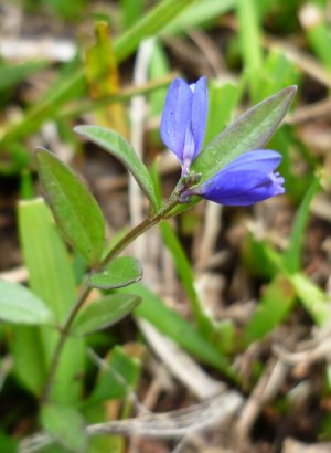
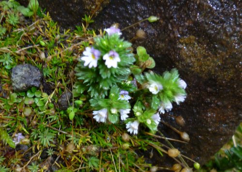
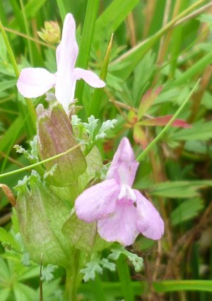
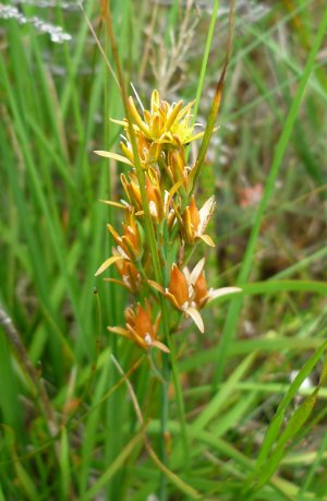

Loch Lomond
Continuing northwest on the M74 (right thru Glasgow) we headed for Glencoe after a brief coffee stop by Loch Lomond. Only 180 miles today. The Red Squirrell campsite by the river looked good, but was very basic (and not cheap). 'Portakabin'-style loos and shower, and our first encounter with the infamous midges.
Sunset from campsite.
We stretched our legs on a short hike up a rough track towards the 'Pap of Glencoe'. Not enough time to get to the top, but new camera worked well on close-ups of floral interest.
bog asphodel milkwort
We were now within easy reach of our first target destination.


Isle of Skye


Beer at Cluanie Inn.
After shopping in Fort William, the next pub en-route that Alec remembered was the Cluanie Inn, so we had to stop for a drink (in the sunshine!). Then on to the Kyle of Lochalsh, 'over the bridge to Skye' doesn't quite match the words of the song!

We turned north, past Portree, to Torvaig campsite on the coast - nice but a bit exposed to the weather. Decided to walk the 1.5 miles back down into Portree for dinner - mistake, we got very wet.

Portree harbour.

The wind and rain were even worse by morning, but when in Scotland you just get on with it. We drove up the coast to climb up to the Old Man of Storr, with the vain hope it might ease up a bit. The well-worn track thru the woods was not too bad, but then we came out into the full force of the weather. We managed to get just to the base of the rock, the loose scree near the top making it even more of a struggle. A peep over the rocky shoulder nearly blowing my head off, we came straight back down again, only pausing for a quick snap of a tiny unknown flower hiding under the rock.


Kilt Rock
A little further up the coast, we saw - thru the veil of rain - the huge basalt columns of Kilt Rock (looking like the pleats of a kilt?) with a dramatic cliff waterfall as a bonus.

Coming back via Portree, we headed for the west side of Skye, to Dunvegan, and a nice lochside campsite at Kinloch. We walked the half-mile up to Dunvegan to treat ourselves to a very posh and expensive dinner at 'The old School' restaurant (not much other choice).

Loch Dunvegan


More beer?
All we had to visit now was the major attraction of Skye - the Cuillin mountains. Going south via Carbost (more beer), we took the narrow road to the campsite at Glenbrittle.No 'dining' options here, so it was self-catering - only bacon and egg for dinner!
Cuillins from Glenbrittle.

The camp site attendant insisted we move the van to the car park before our walk - even though site nearly empty! We hiked the track from the campsite up towards the Alasdair stone chute, bringing back Alec's climbing memories. Plus loads of midges. The last bit was rather a scramble, but the little loch and the base of the stone chute were just below the cloud base.
As we drove back up Glen Brittle and across to Sligachan campsite, the clouds lifted, so more photos to show the mountain-tops.

Alec went native for dinner, with haggis at the Sligachan Inn, for our last night on Skye.

Red Cuillins:
sunset over Sligachan bridge

Black Cuillins:
from Sligachan campsite

Torridon Mountains


Gairloch campsite view.

After shopping at Broadford in Skye, we returned across the Kyle of Lochalsh to the mainland, and headed north into the Highlands. Our problem was finding a suitable campsite - passed by Torridon (small muddy field for tents), Kinlochewe (expensive Caravan Club site). Found our haven further north, at Gairloch - nice site, views across loch, 'proper' showers.

Just off our OS map, so did a waymarked walk to Flowerdale waterfall. Not impressed, 6.5 miles but very tame, and couldn't get angle on falls for photo.

No restaurant so self-catered again - 'Angus beef'-burgers - very good.

Across Loch Maree
with erosion illustration.

Looking for a decent hike in the hills, we drove via Kinlochewe road to start of the 'Beinn Eighe mountain trail' - marked on the OS map beside Loch Maree.

Goldenrod by the loch.

Loch Maree
from nearly the top.
It's steeper than it looks.

Waymark cairn on the mountain trail.


A waymarked walk (climb!) of 4 miles, taking 4 hours. Very well set up, leaflet provided on marked points of interest, cairns on rocky parts, rock steps built up where needed. Bit vertiginous in places (don't look down until you get behind the next large rock!) but very enjoyable.

Loch Allt an Daraich
reflections near top of Beinn Eighe.

Cairngorms


Moray Firth and Inverness bridge
from campsite.

Rather than retrace our route to Gairloch, we headed southeast towards Inverness. Again we rejected the first couple of campsites en-route, then found one to our liking at Bunchrew, just west of Inverness on the Moray Firth. An unexpected bonus was the on-site catering van, where our dinner order was freshly cooked.
Excellent value (soup £2, main £5).

Linn of Dee.
We completed our collection of Scottish mountains with a drive back thru the Cairngorms, via the high route thru Tomintoul (but not photogenic enough to make us stop).

A diversion near Braemar took us to the Linn of Dee gorge and waterfall. A long way up the valley for this small tourist attraction.

Campsites big and pricy in this area, so went on to a small quiet farm site by Loch Tummel.

Loch Tummel
from campsite.
Our last night in Scotland was at Inveraron - a 'backpacker'-style farm+pub+campsite alongside the West Highland way. Walked a couple of miles along it to 'Falls of Falloch' but couldn't get close enough for photo. Severe weather warning later in the afternoon caused them to move everyone up to the carpark in case the river flooded but only the long-distance walkers got drenched.
Ultra-closeup of lousewort beside West Highland Way.

Stormy clouds over Lake District.
On the way home, an overnight diversion into the northern Lake District added another range of hills to our holiday collection. A small farm campsite near Troutbeck and a short walk before the rain returned completed the trip.

Return to Holidays.
Return to Homepage.